

Area & Perimeter Calculator
Rectangular Plot (Length × Width)
Conversions & Notes
| Value | Conversion |
|---|---|
| 📐 Area Units | |
| 1 m² | 10.7639 ft² = 1.19599 yd² |
| 1 ft² | 0.092903 m² |
| 1 yd² | 0.83612736 m² |
| 1 acre | 4046.86 m² = 4840 yd² = 43,560 ft² |
| 1 hectare (ha) | 10,000 m² = 2.47105 acre |
| 1 square mile | 2.58999 km² = 640 acre |
| Regional Units | |
| 1 Marla (Standard) | 25.2929 m² = 272.25 ft² = 30.25 yd² |
| 1 Kanal | 20 Marla = 505.857 m² = 5445 ft² |
| 1 Acre | 8 Kanal = 160 Marla = 4046.86 m² |
| South Asian Units | |
| 1 Bigha (Punjab) | ≈ 1008 yd² = 817.1 m² = 0.2023 acre |
| 1 Bigha (UP/Haryana) | ≈ 2,500–2,700 m² (region dependent) |
| 1 Katha (Punjab) | ≈ 125 yd² = 104.5 m² |
| 1 Guntha | 1/40 acre = 101.17 m² |
| ⚙️ Engineering & Technical Units | |
| 1 cm² | 0.0001 m² |
| 1 mm² | 1e-6 m² |
| 1 m² | 1550.0031 in² |
| 1 yd² | 9 ft² |
| 1 yard | 0.9144 m |
Polygon Plot — Coordinates
x,y — coordinates in chosen length unit.Plot Dimensions Calculator: Calculate Lot Size, Area & Perimeter
Enter your plot dimensions (length and width) to calculate area, perimeter, and common unit conversions including square feet, square yards, square meters, acres, and hectares.
If you need to calculate large farmland, rural tracts, or multi-acre boundary surveys using GPS coordinates, check out our dedicated Land Area Calculator.
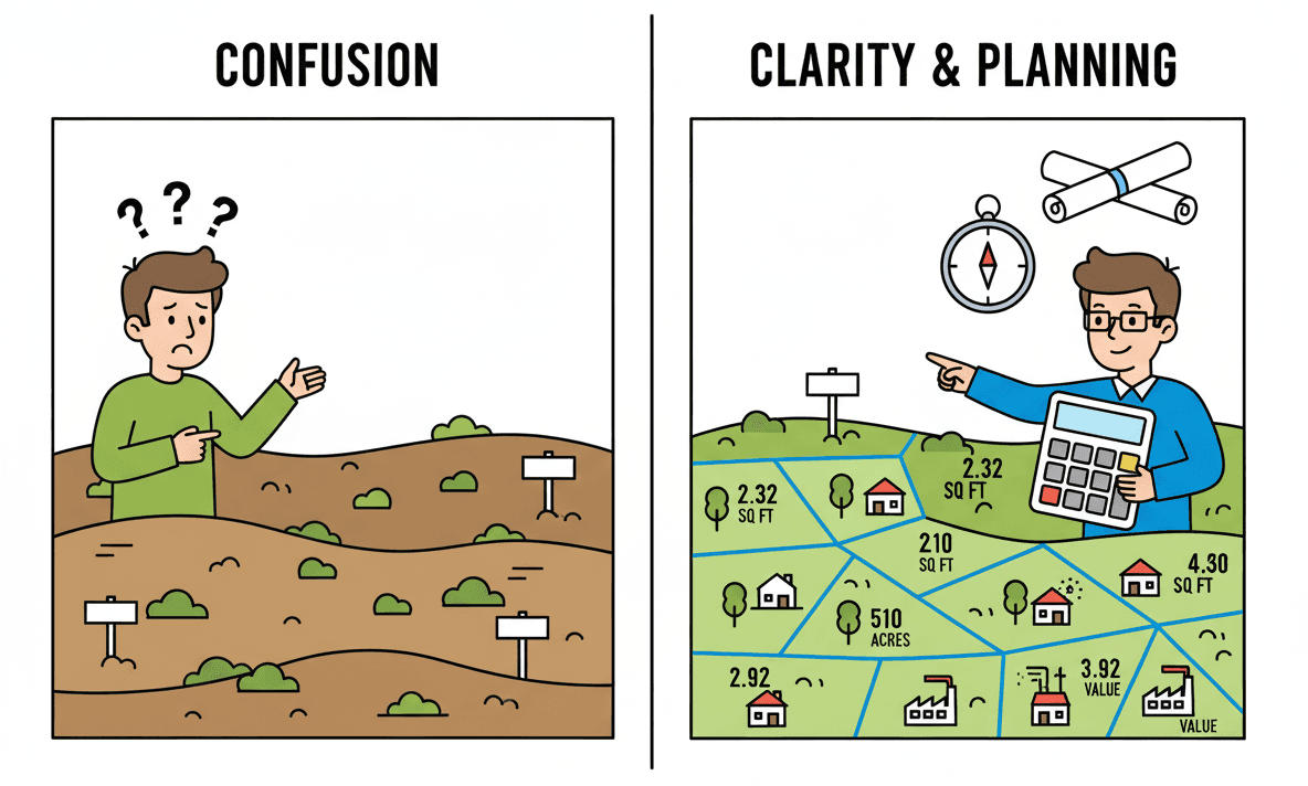
Why Plot Dimensions Matter
Plot dimensions are the starting point for estimating property area, boundary length, fencing needs, and usable space. In the US and Canada, you will often see the term lot size; in many other countries, plot size or land area is more common.
For a rectangular property, two measurements — length and width — are enough to calculate the total area and perimeter. For an irregular property, you need additional side measurements or coordinate points.
What Are Plot Dimensions? (And Why Both Matter)
Plot dimensions are the measurements of your property’s sides. For most rectangular residential plots, you need exactly two dimensions:
- Length — the longer side (depth) of your rectangular plot
- Width — the side along the street or frontage
That’s it. Two numbers. Everything else derives from these.
Length = 98 feet
Width = 66 feet
Area = 98 × 66 = 6,468 sq ft = 718.6 sq yd = 0.148 acres
Perimeter = 2 × (98 + 66) = 328 linear feet
Length vs. Width: Which Is Which?
Simple rule: length is typically the longer measurement. But for a square or nearly-square plot, it doesn’t matter — just enter both dimensions and the calculator handles it.
Why does this matter? Because once you have both dimensions, a plot dimensions calculator instantly gives you three critical numbers:
- Area — the total plot size (how much property you own)
- Perimeter — the total boundary distance (how much fencing/wall you need)
- Unit conversions — the same area expressed in every relevant unit (sq ft, sq yd, acres, sq meters)
How to Measure Your Plot Dimensions (Step-by-Step)
You don’t need expensive equipment. A measuring tape can be sufficient for a basic residential estimate, although larger or legally significant measurements should be verified professionally.
For Rectangular Plots (The Standard Case)
- Get a measuring tape — a 100-foot tape measure is ideal ($15-25). Or use a laser distance measurer ($40-80) for high accuracy.
- Stand at one corner — pick any corner pin and mark it as your starting point.
- Measure the first side — measure along the boundary to the next corner pin. Record this number (Length).
- Measure the perpendicular side — from the same corner, measure along the adjacent side to the next corner (Width).
- Verify the rectangle — measure the diagonal from corner to corner. For a true rectangle with dimensions L and W, the diagonal should equal √(L² + W²).
- Enter into calculator — input both dimensions, pick your unit (feet, yards, meters), and click calculate.
For Irregular/Non-Rectangular Plots
If your plot doesn’t have four right-angle corners, or is L-shaped, use a coordinate approach:
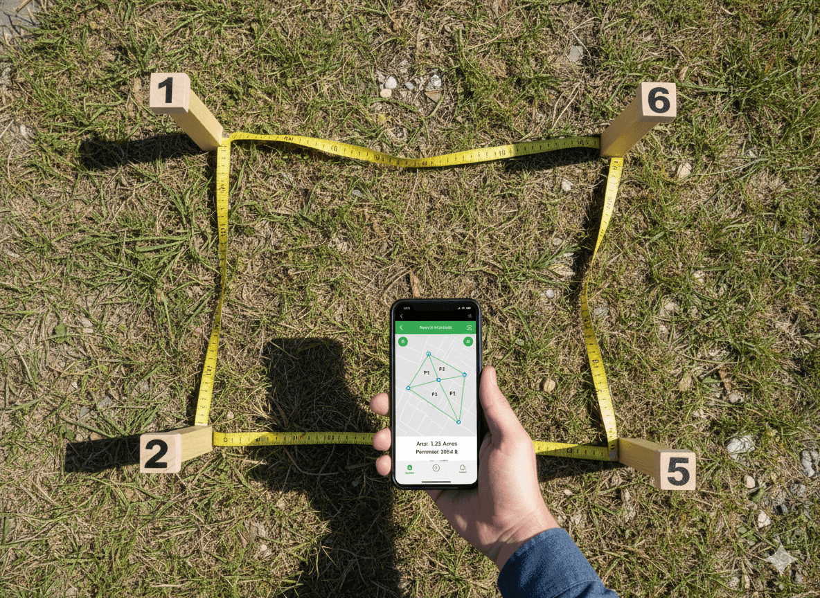
- Mark all corners — walk the entire boundary and physically mark every corner point.
- Establish a reference point — pick one corner as your (0,0) reference point.
- Measure coordinates — for each marked corner, measure horizontal and vertical distance from your reference point. Record as (X, Y).
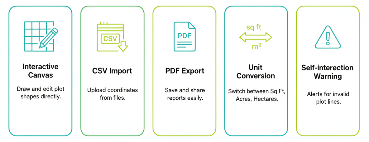
- Enter coordinates into calculator — the “Polygon” mode accepts coordinate points and calculates exact area and perimeter automatically using the Shoelace Formula.
Using a Plot Dimensions Calculator: Three Simple Steps
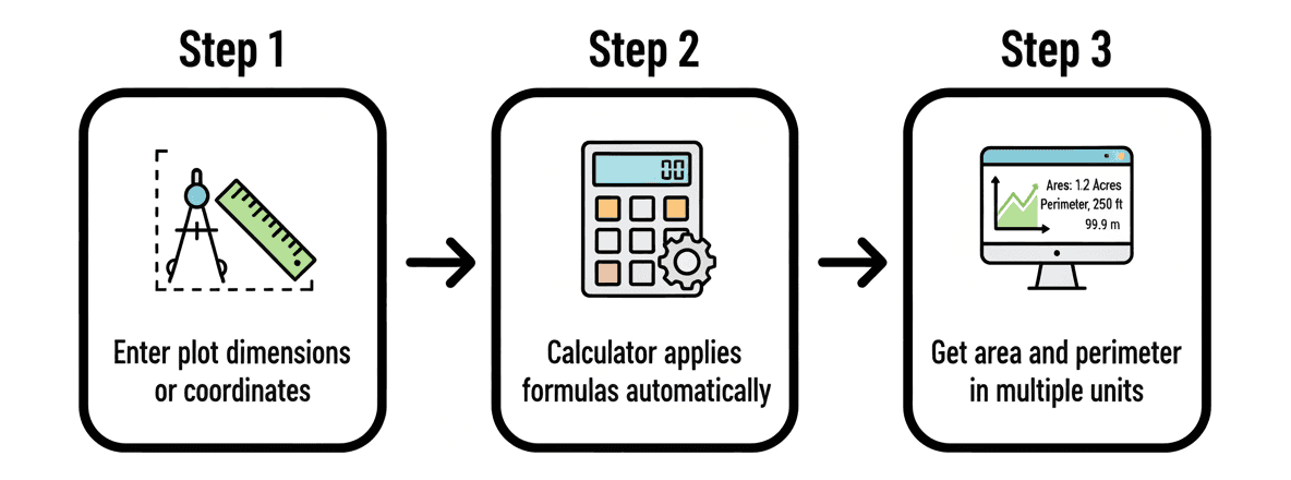
Step 1: Enter Your Plot Dimensions
Choose your unit first (feet, yards, or meters). All inputs must be in the same unit.
Length: 100 [feet] ← measured depth
Width: 50 [feet] ← frontage width
Irregular Plot (Polygon Mode):
Vertex 1: 0, 0
Vertex 2: 100, 0
Vertex 3: 100, 50
Vertex 4: 50, 50
Vertex 5: 50, 80
Vertex 6: 0, 80
(Enter coordinate pairs in order around the boundary)
Step 2: Click Calculate
The calculator instantly processes your plot dimensions and returns:
- Area in sq ft, sq yd, acres, square meters, and hectares
- Perimeter in linear feet, yards, and meters
- Diagonal distance (for lot verification)
Step 3: Use the Results
- For property buying: Compare calculated area against advertised listing size. Mismatch = red flag.
- For fencing: Use linear perimeter to order exact fencing materials and get contractor quotes.
- For construction: Calculate building footprint, lawn coverage, and paving needs.
Plot, Lot, and Land Size: Which Units Should You Use?
The best unit depends on where the property is located. For international readers, it is useful to understand both local terminology and widely used metric or imperial units.
| Region | Common Property Term | Common Area Units |
|---|---|---|
| United States | Lot size | Square feet, acres |
| Canada | Lot size / lot area | Square feet, square meters, acres |
| Europe | Plot size / land area | Square meters, hectares |
| South Asia and some other regions | Plot size | Square feet, square yards, marla, kanal, acres |
US and Canada
For residential lots in the US and Canada, square feet are common for smaller properties, while acres may be used for larger lots. Canada also commonly uses square meters in official and metric contexts.
Europe and Metric Markets
Square meters (m²) are the standard practical unit for most residential plots in Europe. Larger land parcels are often described in hectares, where 1 hectare = 10,000 m².
Plot Dimensions Reference: Common US Lot Sizes
| Property Description | Standard Dimensions (ft) | Typical Area | Common In |
|---|---|---|---|
| Small Urban Lot | 40 ft × 80 ft | 3,200 sq ft (0.073 acres) | Cities, urban infill |
| Standard Residential Lot | 50 ft × 100 ft or 60 ft × 110 ft | 5,000–6,600 sq ft (0.11–0.15 acres) | Suburban developments |
| Quarter Acre (0.25 Acre) | 80 ft × 135 ft or 100 ft × 108 ft | 10,890 sq ft (0.25 acres) | Suburbs & Townships |
| Half Acre (0.50 Acre) | 100 ft × 218 ft or 120 ft × 180 ft | 21,780 sq ft (0.50 acres) | Semi-rural / Large lots |
| Full One Acre | 208.7 ft × 208.7 ft (Square) | 43,560 sq ft (1.00 acre) | Rural estates & Acreage |
Understanding How Plot Dimensions Become Area & Perimeter
The Area Formula
Example: 100 ft × 50 ft = 5,000 sq ft
In other units: 555.5 sq yd = 0.115 acres
The Perimeter Formula
Example: 2 × (100 ft + 50 ft) = 300 linear feet
This represents the exact fence line distance required.
Common Mistakes When Measuring Plot Dimensions
1. Measuring Diagonally Instead of Along Sides
The diagonal is NOT your plot width or length. Always measure straight along boundary lines.
2. Assuming the Plot Is Perfectly Rectangular
If corners are slightly off (88° instead of 90°), simple L × W produces errors. Always measure the diagonal to confirm corners are square.
3. Measuring on Sloped Terrain
Measuring along a hill gives ground distance, not horizontal map area. For sloped land, horizontal plan distance may differ from the distance measured along the ground. For accurate site or legal work, use appropriate surveying methods or a licensed surveyor.
Real-World Example: How Plot Dimensions Save Money
Scenario: Installing a vinyl privacy fence around a quarter-acre suburban lot at $28 per linear foot installed.
Estimated perimeter: 300 feet
Estimated cost: 300 × $28 = $8,400
Actual Dimensions (Laser Measured):
Length: 95 feet | Width: 108 feet
Calculated perimeter: 2 × (95 + 108) = 406 linear feet
Actual cost: 406 × $28 = $11,368
Difference: $2,968 variance.
Measuring beforehand prevents running short on materials mid-installation and incurring rush delivery fees.
Does Lot Area Equal Buildable Area?
No. The total plot or lot area is the area inside the legal property boundary. The amount you can actually build on may be smaller because of setbacks, easements, zoning rules, building codes, access requirements, or other local restrictions.
Use the calculator for area and perimeter estimates, but check local planning and zoning requirements before treating the calculated area as buildable space.
When to Hire a Professional Surveyor
DIY measuring works for fencing, landscaping, and preliminary lot checks. Hire a licensed land surveyor for:
- Property transactions: Legal requirements vary by jurisdiction; use a licensed surveyor when an official boundary or survey is required.
- Boundary disputes: Boundary disputes may require evidence from a licensed surveyor or other legally recognized survey documentation.
- Large tracts (Over 2-3 acres): Tape measures accumulate error over long distances.
Frequently Asked Questions
1. How do I know which dimension is length and which is width?
Length is typically the longer side or lot depth, while width is commonly the frontage along the street. For area calculations, the order does not matter because Length × Width gives the same result either way.
2. How many square feet are in a quarter-acre lot?
A full acre contains 43,560 square feet, so a quarter-acre equals exactly 10,890 square feet. The dimensions can vary because many different rectangles can have the same area.
3. How do I calculate linear feet of fencing from my plot dimensions?
For a rectangular lot, use the perimeter formula: 2 × (Length + Width). For example, a 60 ft × 120 ft lot has a perimeter of 360 linear feet before allowing for gates or other design changes.
4. What should I do if my physical measurements show a lot is smaller than advertised?
Re-measure carefully to rule out measurement error. If the discrepancy remains and the property is being bought or sold, compare the result with the property documents and request an official survey or professional verification before relying on the advertised size.
5. Can I measure plot dimensions using a smartphone GPS app?
GPS and mapping apps can provide estimates, but their accuracy varies. For a legal boundary, construction layout, or property transaction, use appropriate measurement methods or a licensed surveyor rather than relying on a phone estimate alone.
6. What are common dimensions for a suburban house lot?
US suburban lots vary widely by city and development. Examples include 50 ft × 100 ft (5,000 sq ft) and 60 ft × 110 ft (6,600 sq ft), while larger properties may be described as quarter-acre or half-acre lots. These are examples, not universal standards.
7. How do I calculate the area of an L-shaped or irregular plot?
For an L-shaped plot, divide it into simple rectangles, calculate each area, and add them together. For more complex boundaries, coordinate-based polygon calculations can be used when accurate vertex measurements are available.
8. Do plot dimensions include setbacks, driveways, and sidewalks?
The plot dimensions normally describe the property boundary, not the portion you are legally allowed to build on. Setbacks, easements, zoning rules, and other restrictions can reduce the usable or buildable area. Check the applicable property documents and local regulations.
Bottom Line
Every land decision starts with exact plot dimensions. Length and width determine total area, fencing perimeter, and fair market value. Measure once, calculate twice, and proceed with confidence.